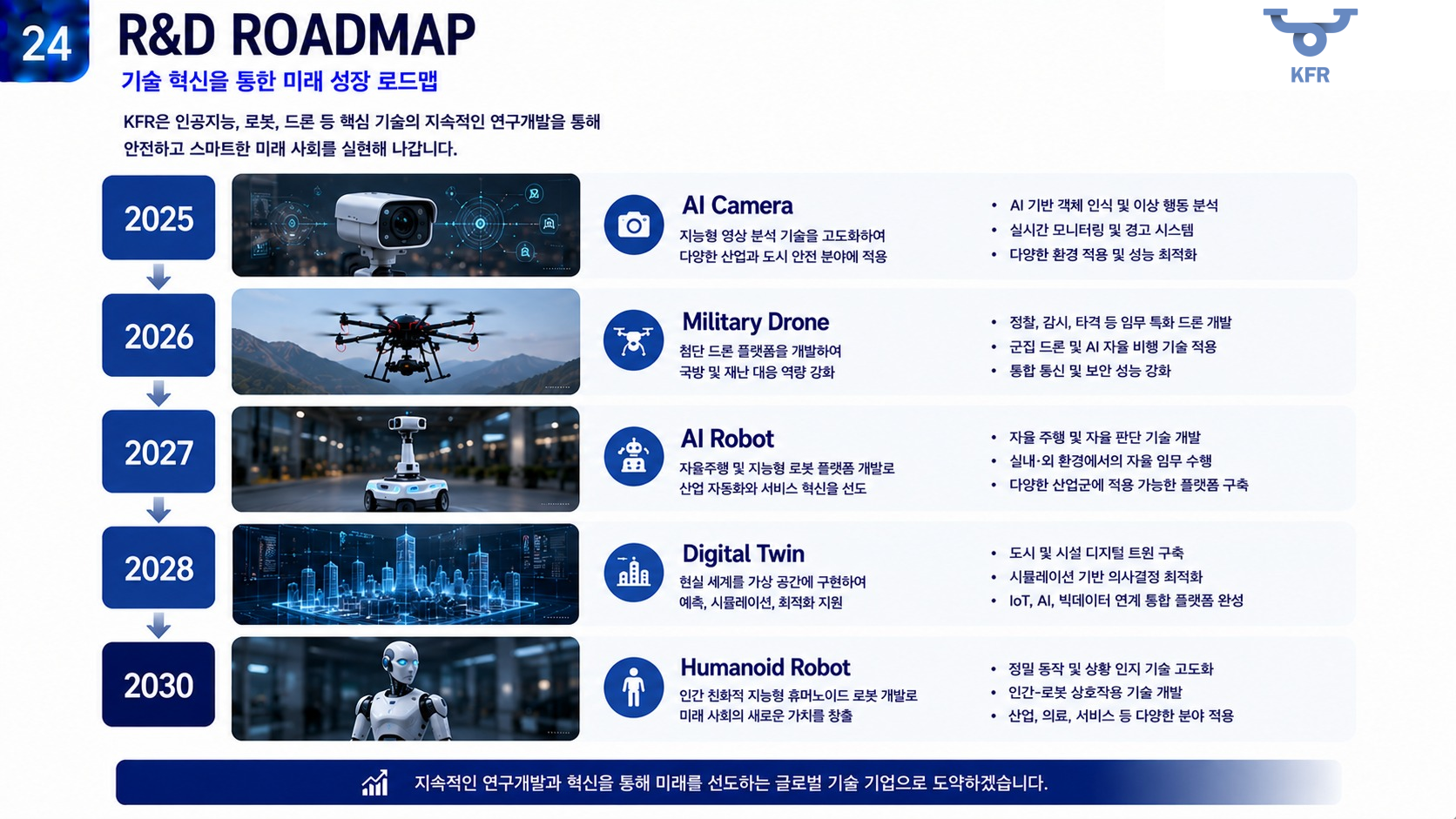
R&D ROADMAP
2025 · AI Camera
Develop object recognition, abnormal behavior analysis and real-time monitoring and alerts for industrial and urban safety applications.
Define the objects and events relevant to each camera environment and connect detection results to alerts and operator views. This stage establishes a visual-perception foundation that can later inform drones and robots.
R&D ROADMAP
2026 · Drone
Develop mission-specific reconnaissance and surveillance platforms with closer integration of flight, communications and control.
Consider the connection between aircraft and mission equipment and define how video and status will be reviewed in the field. Configuration and testing scope follow the customer’s operational requirements.
R&D ROADMAP
2027 · AI Robot
Connect autonomous navigation, situational awareness and task execution, with broader indoor and outdoor applications.
Study the layout and recurring tasks in a robot’s operating space to define navigation and supervision needs. Shared spaces also require consideration of status visibility and how operators can intervene.
R&D ROADMAP
2028 · Digital Twin
Link field data to virtual models of cities and facilities for monitoring, simulation and decision support.
Bring information from cameras, mobile systems and sensors together within a spatial model. The focus extends from individual device status to understanding how the wider site operates.
R&D ROADMAP
2030 · Humanoid Robot
A long-term direction for precise motion, situational understanding and human–robot interaction. Specifications and schedules depend on validation and business progress.
Building on perception and mobility, this direction examines interaction that connects human instructions to tasks. Practical use requires mechanical design, control and environmental perception to be validated together, informed by experience from earlier stages.
View details